

USGS EarthExplorer: Complete Guide to Accessing Satellite Imagery in 2026

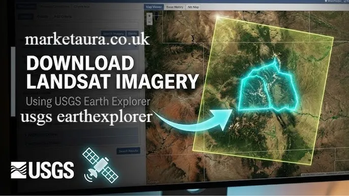
Introduction
Have you ever wondered what your neighborhood looked like ten years ago from space? Or wanted to analyze land use changes in a specific region? USGS EarthExplorer makes this possible. This remarkable tool has revolutionized how scientists, planners, and professionals access Earth observation data. If you work in environmental science, urban planning, agriculture, forestry, or geology, understanding how to use USGS EarthExplorer can transform your research capabilities. The platform eliminates barriers that once made satellite imagery expensive and difficult to obtain. Today, anyone can access the same data that major government agencies and corporations use.
USGS EarthExplorer stands out because it combines ease of use with professional-grade functionality. You do not need to be a remote sensing expert to navigate the interface. The tool guides you through searching, previewing, and downloading satellite imagery with straightforward steps. Whether you are monitoring forest health, tracking urban sprawl, studying water resources, or conducting academic research, USGS EarthExplorer provides the data you need at no cost. This article will walk you through everything you need to know about USGS EarthExplorer, from basic navigation to advanced image downloading techniques.
How Do I Use USGS EarthExplorer?
Using USGS EarthExplorer involves a straightforward process that anyone can learn. The platform is designed to be intuitive, even for first-time users. Here are the essential steps to get started with USGS EarthExplorer:
Creating Your Account
The first step is setting up a free account on USGS EarthExplorer. Visit the website and click on the registration option. Provide your email address, create a password, and add basic information. The registration process takes only a few minutes. Once you have confirmed your email, you can log in immediately.
Having an account allows you to save searches and access download history. It also enables you to organize your work by creating collections of imagery. Many users appreciate this organizational feature because it helps track multiple research projects efficiently.
Navigating the Search Interface
After logging in, you will see the main interface for USGS EarthExplorer. The left panel contains search criteria options. Start by defining your area of interest using the map or by entering coordinates. You can draw a polygon, upload a shape file, or simply click on the map to mark your study area.
Next, select your date range. This is where USGS EarthExplorer becomes incredibly powerful. You can choose imagery from specific seasons or years. This temporal flexibility lets you compare environmental conditions across decades.
Then, choose your data source. Landsat imagery is the most popular option, but USGS EarthExplorer also offers data from other sensors including Sentinel, ASTER, and aerial photography collections.
Filtering Results
Once you set your basic parameters, use the filtering options to narrow your results. You can filter by cloud coverage percentage. This is crucial because cloudy images are useless for most analysis work. Most users search for imagery with less than twenty percent cloud cover.
You can also filter by image quality and availability. USGS EarthExplorer shows you exactly which products are available for your selected area and dates.
Preview and Selection
When results appear, preview images before downloading. The preview function lets you see thumbnail versions and metadata. This saves bandwidth and confirms you have selected the right imagery. Once you find what you need, add the images to your cart for downloading.
How Do I Download Images from EarthExplorer?
Downloading images from USGS EarthExplorer is straightforward once you understand the process. The platform offers flexibility in how you acquire your data.
Step By Step Download Process
- Select the images you want from your search results
- Click the download button next to each image or select multiple images to download as a batch
- Choose your product type (different processing levels are available)
- Select your output format and projection preferences
- Confirm your download order
- USGS EarthExplorer will process your request and email you a download link within minutes or hours
Understanding Product Levels
Landsat data in USGS EarthExplorer comes in different processing levels. Level one products are raw sensor data that require processing. Level two products are atmospherically corrected and georeferenced. Most users prefer level two because it requires less preprocessing. However, level one products are useful if you want to apply your own atmospheric corrections.
Download Size Considerations
Landsat imagery files are large, typically ranging from one hundred megabytes to several gigabytes per scene. High resolution imagery from other sensors can be even larger. Plan for sufficient storage space before downloading. Download speeds depend on your internet connection and server load times.
Organizing Downloaded Data
Create a logical folder structure for organizing downloaded imagery. I recommend organizing by project name, then by sensor type, and finally by date. This system helps you quickly locate specific images months or years later.
Is USGS EarthExplorer Free?
Yes, absolutely. USGS EarthExplorer is completely free. There are no subscription fees, download charges, or hidden costs. The United States Geological Survey provides this service to the public as part of its mission to provide scientific data and research.
This free access represents an enormous value. Commercial satellite imagery providers charge thousands of dollars for the same data. Researchers and organizations that would have struggled to afford imagery decades ago can now access decades of satellite records at no cost. This democratization of Earth observation data has accelerated scientific research and environmental monitoring globally.
The only costs you might incur are those related to storage, processing, and analysis of the data on your own systems. Your internet connection and computer resources are what you invest, not money to USGS EarthExplorer itself.
How Do I Find Landsat Images in EarthExplorer?
Landsat imagery is the primary data source in USGS EarthExplorer. These satellites have been collecting Earth observation data since the 1970s, creating an unparalleled archive of our planet.
Accessing Landsat Data
To find Landsat images, start by searching for your area of interest. In the data source section, select Landsat. The platform offers imagery from multiple Landsat missions, including Landsat 5, Landsat 7, and Landsat 8/9. Each mission has different specifications and spectral bands.
Understanding Landsat Missions
Landsat 5 imagery is historic, covering decades of Earth observation. Landsat 7 has some technical issues but still provides valuable data. Landsat 8 and 9 are modern satellites with improved sensors. Most contemporary research uses Landsat 8/9 data.
Each Landsat satellite returns to the same location every sixteen days. This revisit frequency means you can track changes over time. Agricultural monitoring, disaster response, and environmental assessment all benefit from this regular observation pattern.
Spectral Bands and Applications
Landsat provides multispectral imagery with multiple bands capturing different wavelengths. These bands enable various analyses. The near infrared band is excellent for vegetation studies. Thermal bands measure surface temperature. Visible light bands create natural color images.
USGS EarthExplorer lets you work with individual bands or composite images. Composite images combine multiple bands to create enhanced visualizations useful for different analysis purposes.
Finding Cloud Free Imagery
Finding clear Landsat images can be challenging in tropical or frequently cloudy regions. Expand your date range to increase options. Check seasonal patterns. Dry seasons typically offer clearer skies. Use the cloud cover filter aggressively to narrow results to the clearest possible images.
Step By Step Guide to Accessing Remote Sensing Data
Define Your Research Area
Start by precisely defining where you want to study. Use USGS EarthExplorer’s mapping tools to draw your area of interest. If you have existing shape files from GIS work, you can upload them directly. This ensures your search captures exactly what you need.
Select Appropriate Dates
Think carefully about your temporal requirements. Do you need seasonal comparisons? Do you want data from a specific year? USGS EarthExplorer lets you search by individual dates or date ranges. This flexibility supports various research questions.
Choose Relevant Sensors
Different sensors capture different information. Landsat excels at medium resolution monitoring over large areas. ASTER data provides finer resolution but less frequent coverage. Aerial photography offers high resolution for smaller areas. Match your sensor selection to your analysis needs.
Apply Quality Filters
Cloud cover matters enormously. Water bodies reflect clouds. Shadows affect analysis accuracy. Use USGS EarthExplorer’s quality filters to narrow results to usable imagery. Most analysts want imagery with less than twenty or thirty percent cloud cover.
Download and Process
Download your selected imagery and import it into GIS software for analysis. USGS EarthExplorer provides data in standard formats compatible with all major GIS platforms. Processing techniques depend on your specific analysis goals.
Using USGS EarthExplorer for Environmental Monitoring
USGS EarthExplorer satellite imagery enables environmental professionals to monitor land use changes, track deforestation, assess agricultural health, and respond to natural disasters. Forest managers use Landsat data to identify burned areas after wildfires. Hydrologists track river dynamics and flooding extent. Urban planners monitor city expansion. Conservation organizations measure habitat loss. The applications are nearly endless.
Remote sensing through USGS EarthExplorer provides data that would be impossible to collect through ground surveys alone. You can observe vast areas rapidly and consistently. Temporal analysis reveals trends that might take decades to notice on the ground. This makes USGS EarthExplorer invaluable for understanding global environmental change.
Integrating USGS EarthExplorer Data with GIS Software
Once you download imagery from USGS EarthExplorer, most GIS professionals import it into analysis software. Standard GIS platforms accept Landsat imagery without compatibility issues. The data comes in widely supported formats like GeoTIFF. This ensures you can work with the data using your existing tools and workflows.
Many organizations combine USGS EarthExplorer satellite imagery with other spatial data. Elevation data from the Shuttle Radar Topography Mission is available in USGS EarthExplorer. You can merge elevation data with spectral imagery to create comprehensive datasets for complex analyses.
Conclusion
USGS EarthExplorer represents a remarkable achievement in making Earth observation data accessible to everyone. Whether you are a student learning remote sensing basics, a researcher conducting environmental studies, a professional planning infrastructure projects, or anyone curious about how our planet looks from space, USGS EarthExplorer provides the tools and data you need. The platform continues evolving, adding new satellite imagery and improving functionality. Free access to decades of satellite imagery has transformed environmental science, conservation, and policy making. Start exploring today and discover what satellite imagery can reveal about your area of interest. What environmental questions do you want to answer using satellite data?
Frequently Asked Questions
1. What is the difference between USGS EarthExplorer and other satellite imagery platforms?
USGS EarthExplorer specializes in free access to U.S. government satellite data, particularly Landsat. It prioritizes accessibility and provides extensive historical archives. Some other platforms offer different satellite sources or enhanced processing tools, but few match the free access to such comprehensive historical data.
2. Can I use USGS EarthExplorer satellite imagery for commercial purposes?
Yes. Most USGS EarthExplorer data is in the public domain with minimal restrictions. Check the specific dataset documentation, but generally commercial use is allowed. This makes USGS EarthExplorer valuable for businesses as well as researchers.
3. How far back does USGS EarthExplorer imagery go?
Landsat has been collecting imagery since nineteen seventy two. USGS EarthExplorer provides access to most of this archive. Earlier imagery may have lower resolution or less complete coverage than modern data, but extensive historical records exist.
4. What is the resolution of Landsat imagery in USGS EarthExplorer?
Landsat 8 and 9 provide thirty meter resolution multispectral imagery. This means each pixel represents thirty meters by thirty meters on the ground. This resolution is excellent for regional and landscape scale studies, though too coarse for detailed site analysis.
5. Do I need special software to use USGS EarthExplorer data?
No, but most users employ GIS software for analysis. Standard GIS platforms like ArcGIS or open source options like QGIS work perfectly with USGS EarthExplorer data. However, you can view preview images directly in USGS EarthExplorer without additional software.
6. How quickly can I download imagery from USGS EarthExplorer?
Download links are usually generated within minutes to a few hours. Processing time depends on data format, product level, and current server load. You receive an email notification when your order is ready for download.
7. Can USGS EarthExplorer track real time changes?
Landsat revisits the same location every sixteen days, so it is not truly real time. However, this revisit frequency is excellent for tracking environmental changes over weeks and months. For faster updates, some other satellite systems offer daily coverage.
8. What should I know about metadata when downloading from USGS EarthExplorer?
USGS EarthExplorer provides comprehensive metadata with each image. Metadata includes acquisition date, cloud cover percentage, sun angle, and processing information. Understanding metadata helps you select appropriate imagery and interpret your results correctly.
9. Can I access USGS EarthExplorer offline?
No, USGS EarthExplorer is a web based platform requiring internet access. However, you can download imagery and analyze it offline once it is on your computer.
10. What if I need higher resolution satellite imagery than USGS EarthExplorer provides?
USGS EarthExplorer does offer some higher resolution sources like aerial photography. For very high resolution imagery, you would need to purchase commercial satellite data, as free sources typically offer lower resolution.
About the Author : Marcus Chen is a geospatial analyst and remote sensing specialist with over eight years of experience in environmental monitoring and GIS analysis. Marcus holds a degree in geography with a focus on Earth sciences and has worked with satellite imagery for conservation projects, urban planning initiatives, and climate research across multiple continents. When not analyzing imagery, Marcus enjoys mentoring students in remote sensing techniques and exploring how satellite data reveals patterns of environmental change. Marcus regularly contributes to the geospatial community through technical writing and has helped hundreds of professionals learn to effectively use USGS EarthExplorer for their research and professional work.
email: johanharwen@314gmail.com
Author Name: Marcus Chen
