

Introduction
A Lakeshore Flood Watch can sound confusing, especially if you have never lived near a large lake. The message does not mean flooding is already happening. It means conditions could produce significant flooding along the shoreline, and you should prepare before the situation becomes more serious.
The National Weather Service uses a Lakeshore Flood Watch when significant lakeshore flooding is possible. Depending on the local forecast office, the watch may be issued roughly 12 to 48 hours before expected impacts.
This warning matters most for people who live, work, travel, or operate businesses near vulnerable shorelines. Strong winds, large waves, high lake levels, and storm systems can push water onto normally dry land. The combination can also cause erosion, damage roads, affect boats, and flood low lying areas.
In this guide, you will learn what a Lakeshore Flood Watch means, what causes lakeshore flooding, how it differs from a warning, and what you should do to protect yourself and your property.
What is a Lakeshore Flood Watch?
A Lakeshore Flood Watch means significant flooding along a lake shoreline is possible.
The National Weather Service defines a Coastal or Lakeshore Flood Watch as a situation where flooding with significant impacts is possible. A watch does not confirm that flooding will occur. Instead, it tells you that weather and water conditions are favorable for flooding.
Think of a watch as an early preparation signal.
You should use the time to monitor updates, protect vulnerable property, move vehicles away from exposed areas, and prepare to leave if officials later issue a warning or evacuation order.
What does a Lakeshore Flood Watch mean for you?
| Weather message | Meaning | What you should do |
|---|---|---|
| Lakeshore Flood Watch | Significant flooding is possible | Prepare and monitor updates |
| Lakeshore Flood Advisory | Minor flooding is possible | Use caution near the shoreline |
| Lakeshore Flood Warning | Serious flooding is occurring or likely soon | Take immediate protective action |
Local National Weather Service offices may use slightly different timing criteria. For example, the National Weather Service office in Detroit describes a lakeshore flood watch as notice that flooding is possible and recommends issuing it 12 to 36 hours in advance.
Why does lakeshore flooding happen?
Lakeshore flooding usually develops from several factors working together.
A major storm can create strong winds across a large lake. Those winds push water toward one side of the lake. Large waves can then carry water onto beaches, roads, parks, and other low lying areas.
High lake levels can make the situation worse.
NOAA explains that short term Great Lakes water level changes caused by wind and storms can be dramatic. Water levels between different sides of a lake can vary by several meters for short periods.
The main factors include:
- Strong winds
- Large waves
- High lake levels
- Storm systems
- Shoreline shape
- Nearshore water depth
- Heavy precipitation
- Wave runup
- Seiche conditions
Your location can therefore experience flooding even when the overall lake level does not appear unusually high.
How do strong winds increase flood risk?
Wind is one of the most important factors during a lakeshore flooding event.
When strong winds blow across a large section of a lake, they can push water toward the downwind shoreline. This process can temporarily raise water levels in one area.
The effect can become more dangerous when large waves arrive at the same time. marketaura
A shoreline that normally remains dry can suddenly experience waves reaching roads, buildings, walkways, and other structures.
This is why you should never judge flood risk by looking only at the average lake level.
What is a seiche and why does it matter?
A seiche is a temporary oscillation of water within a lake.
Strong winds and changes in atmospheric pressure can move water toward one side of a lake. When the weather pattern changes, the water can move back and forth.
This movement can produce rapid water level changes.
NOAA notes that short term changes caused by storms can produce major differences in water levels across the Great Lakes.
For people near the shoreline, this means conditions can change quickly even when the weather appears to be improving.
Where is lakeshore flooding most dangerous?
Flooding does not affect every shoreline equally.
The National Weather Service notes that lakeshore flooding depends heavily on local coastline topography and nearshore bathymetry.
Higher risk areas can include: source: National Weather Service (.gov)
- Low lying beaches
- Waterfront roads
- Marinas
- Boat launches
- Shoreline parks
- Coastal homes
- Low elevation neighborhoods
- Areas near bays
- Locations beside connecting waterways
If you live near a lake, learn which parts of your community normally flood first.
That local knowledge can help you respond faster when a watch becomes a warning.
What should you do during a Lakeshore Flood Watch?
A watch gives you valuable preparation time.
Start with these steps:
1. Check the latest forecast
Monitor updates from the National Weather Service and your local emergency management agency.
Pay attention to the expected timing, affected locations, wind conditions, wave heights, and potential impacts.
2. Move vehicles
If your vehicle is parked near the shoreline, move it to higher ground before water reaches the road.
Do not wait until flooding begins.
3. Protect important belongings
Move documents, electronics, tools, and other valuables away from areas that could flood.
If you own a waterfront business, inspect storage areas and vulnerable equipment.
4. Secure outdoor items
Bring loose furniture, equipment, decorations, and other objects indoors when possible.
Strong winds and waves can turn unsecured objects into hazards.
5. Stay away from the water
A flooded shoreline can contain powerful waves and rapidly changing water levels.
Avoid walking along breakwaters, piers, beaches, and exposed shoreline structures during dangerous conditions.
6. Prepare for road closures
Floodwater can cover roads faster than expected.
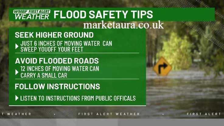
Have an alternative route ready and avoid driving through water. source: UNESCO
Can a Lakeshore Flood Watch become a warning?
Yes.
A watch can become a Lakeshore Flood Warning when flooding becomes occurring, imminent, or highly likely and poses a serious threat to life or property.
The change from watch to warning is important.
A watch tells you to prepare.
A warning tells you to act.
If officials issue an evacuation order, follow it immediately. Do not wait to see how high the water becomes.
How is lakeshore flooding different from river flooding?
The two hazards involve different sources of water.
River flooding usually develops when a river or stream rises beyond its banks because of rainfall, snowmelt, runoff, or other hydrological factors.
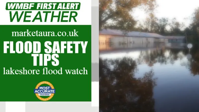
Lakeshore flooding happens when lake water reaches normally dry land along the shoreline.
The National Weather Service explains that Great Lakes lakeshore flooding can affect the immediate lakefront, bays, and areas where lakes connect with rivers and other waterways.
Understanding the difference helps you interpret weather alerts correctly.
What damage can lakeshore flooding cause?
Lakeshore flooding can range from minor water overflow to extensive inundation and severe beach erosion.
Potential impacts include:
- Flooded roads
- Eroded beaches
- Damaged seawalls
- Flooded basements
- Damage to waterfront structures
- Disrupted marina operations
- Dangerous driving conditions
- Damage to landscaping
- Loss of shoreline property
- Rapid changes in water conditions
Past Great Lakes high water periods demonstrate the potential scale of the problem. NOAA reports that each Great Lake experienced record high water levels at some point between 2017 and 2020, with coastal flooding and erosion causing property damage during that period.
How does NOAA monitor Great Lakes water levels?
NOAA and Canadian agencies continuously monitor Great Lakes water levels through a binational monitoring network.
NOAA reports that 53 U.S. monitoring stations operated by the National Ocean Service track water levels across the Great Lakes and connecting channels. Canadian agencies operate additional monitoring stations along the Canadian shoreline.
These observations support forecasting and research.
NOAA also provides the Great Lakes Water Level Dashboard, which allows users to examine historical and forecast water level information.
This information can help communities understand changing flood risk.
What statistics help explain Great Lakes water levels?
Great Lakes water levels naturally change throughout the year.
NOAA reports that annual water level fluctuations generally range from about 11 to 20 inches. The lakes are generally lowest during winter and reach their highest levels during summer or fall.
The historical record also shows substantial long term variation.
NOAA reports that the overall range of Great Lakes water levels since 1918 is slightly more than 7 feet.
These numbers show why shoreline communities need both short term storm forecasts and long term water level information.
What expert guidance should you follow?
The most important guidance comes from agencies that monitor weather and water conditions.
The National Weather Service provides official alerts and impact information.
NOAA provides Great Lakes water level observations, forecasts, and research.
The U.S. Army Corps of Engineers and Environment and Climate Change Canada also contribute to Great Lakes water level forecasting. NOAA states that these agencies collaborate on seasonal water level forecasts for the basin.
For your safety, always give priority to local emergency instructions over general online commentary.
What should you remember during a Lakeshore Flood Watch?
Keep these points in mind:
- A watch means significant flooding is possible.
- Flooding may develop because of strong winds and waves.
- High lake levels can increase the risk.
- Shoreline geography can greatly affect local impacts.
- Water conditions can change quickly.
- A warning means the threat is more immediate.
- Never walk or drive through dangerous floodwater.
- Follow evacuation instructions from local officials.
Frequently Asked Questions
What is a Lakeshore Flood Watch?
A Lakeshore Flood Watch means significant flooding along a lakeshore is possible. It gives you time to prepare before conditions potentially become more dangerous.
Is a Lakeshore Flood Watch dangerous?
It can be. A watch does not mean flooding is already occurring, but the expected conditions may create significant impacts.
What causes lakeshore flooding?
Strong winds, large waves, high lake levels, storms, shoreline shape, and changes in water movement can contribute to lakeshore flooding.
What is the difference between a Lakeshore Flood Watch and warning?
A watch means significant flooding is possible. A warning means serious flooding is occurring, imminent, or highly likely.
Can high waves cause lakeshore flooding?
Yes. Large waves can push water onto normally dry shoreline areas, especially when strong winds and elevated lake levels occur together.
Should you drive during a Lakeshore Flood Watch?
Only if necessary and if roads remain safe. Avoid flooded roads and follow local road closure instructions.
How long does a Lakeshore Flood Watch last?
The duration depends on the weather event and local forecast. Follow the latest National Weather Service updates for the specific location and time period.
Does lakeshore flooding only happen on the Great Lakes?
The National Weather Service uses the term Lakeshore Flooding specifically for flooding along the Great Lakes. Other lake communities can experience similar flooding hazards, although local authorities may use different terminology.
Conclusion
A Lakeshore Flood Watch is an important early warning that significant shoreline flooding could develop. It gives you time to prepare, protect property, move vehicles, and monitor official updates.
The risk often comes from a combination of strong winds, large waves, elevated water levels, and local shoreline conditions. NOAA monitoring shows that Great Lakes water levels naturally fluctuate, while storms can produce much faster short term changes.
The best approach is simple. Take a watch seriously, stay informed, and be ready to act if authorities issue a warning.
If you live near a Great Lake, knowing your local flood prone areas before the next storm can make a real difference.
Author Bio: Weather and Safety Content Team The Weather and Safety Content Team creates clear, practical articles about weather alerts, environmental hazards, and emergency preparedness. The team focuses on making technical information easier for everyday readers to understand and use.
email: johanharwen@314gmail.com
Author Name: Weather and Safety Content Team